Tools
A guide to the historical maps and survey records used by this library, with a clear separation between a record’s historical information and a current geographic conclusion.
Historical maps and diagrams, 1875–1952
Original scans and archival descriptions, with dates checked against the drawings.
- 1875 Foreman township field-note index diagram — field notes, page 415
- 1876 township plat — 100 UR 445
- Belcher atlas of Humboldt County, sheet 2 — 6 UR 354
- 1923 Lentell Survey No. 235 — 8 RS 72–75
- 1929 Standish & Hickey Survey No. 173 — 9 RS 82
- 1947 proposed road right-of-way map — 3 UR 137
- 1950 Morrison & Jackson Lumber holdings — 3 UR 159
- 1952 R. Cathey et al. survey — 3 UR 135
General location, not a boundary map#
Public State Parks material places the Jay Smith Road area in southern Humboldt County, in the context of Humboldt Redwoods State Park and north of Miranda. This library does not publish a guessed coordinate, road endpoint, parcel outline, ownership boundary, or easement map. Those questions require appropriately authoritative and current evidence.
1876 township plat#
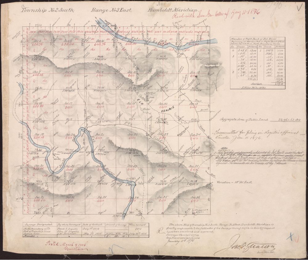
Township 2 South, Range 3 East plat#
1876; county survey record copy 100 UR 445. The plat supplies the historical Humboldt Meridian township-and-section framework found in later descriptions.
1947 proposed road map#
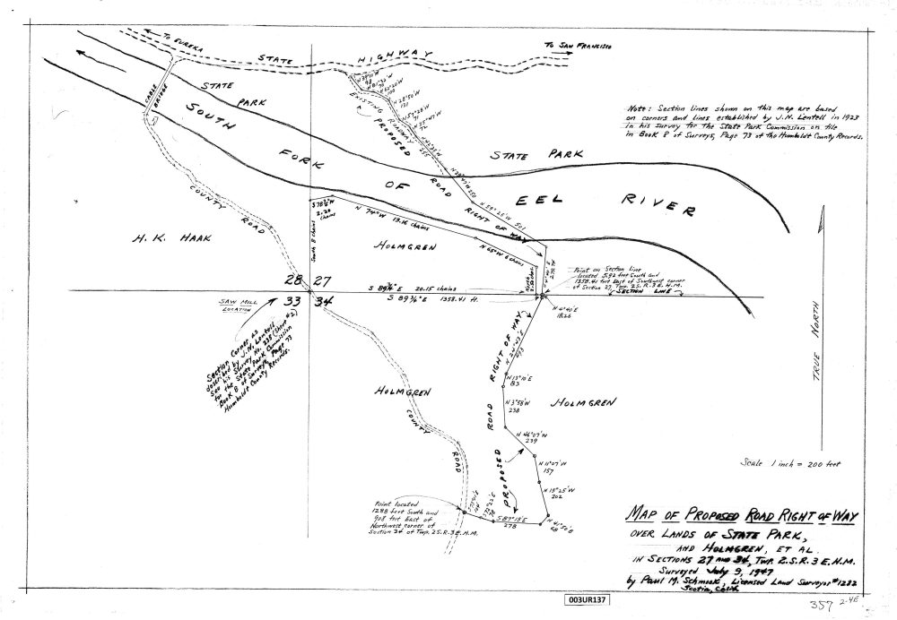
Proposed road right-of-way map#
1947; county record 3 UR 137. It documents a proposed historical alignment.
Related research sources#
The library’s survey article explains the 1872–1876 chronology and its unresolved elements. The National Archives Record Group 49 guide is a research lead for federal land-office records; it is not presented as confirmation of a specific field-note citation.
Read the Humboldt Meridian survey history · Browse all historical records
Last materially updated and reviewed: 8 September 2026.
Which map answers which question?#
The 1876 township plat and 1947 proposed-road map have different purposes. The 1876 plat is a township-level survey source. The 1952 road drawing documents a proposed alignment. They belong in the same research collection because they help explain the historical setting, but they should not be treated as successive editions of one map.
Township plat#
Start with 100 UR 445 to identify the township, range, and meridian notation. Then use the survey-history article for the chronology and archival questions. The fact that a later description uses the same survey framework does not establish that every later feature appears on the early plat.
Proposed road map#
Read 3 UR 137 as a historical proposal. Preserve that qualifier when describing its relevance. The drawing alone cannot document whether construction occurred, whether an alignment changed, or whether a route is available for present travel.
Park maps and regional orientation#
The California State Parks park brochure shows the broader Humboldt Redwoods setting and the communities of Myers Flat and Miranda. The Avenue of the Giants overview connects this regional geography to the historical library. Park mapping is a source for the geography it actually depicts, rather than a replacement for a recorded survey.
A practical method for comparing historical maps#
- Identify the source. Record the complete title, date, county or archive reference, and whether the item is a plat, proposal, or another map type.
- Open the full document. A thumbnail helps locate an item, but may be too small to read its legend, scale, annotations, or qualifications.
- Separate observations from conclusions. Describe a feature shown on the document before attempting to connect it with a feature on a different map.
- Keep chronology visible. Distinguish the survey's historical dates from the date a copy entered the library.
- Retain unresolved questions. A missing construction record or unconfirmed field-note reference is a gap to research, not an invitation to draw a new boundary.
The historical timeline helps compare dates across map, utility, and deed records. The water-history article gives an example of why a document's physical reference and the unknown source of water must remain separate.
Humboldt County survey records and archival research#
The County Surveyor's resource page links to the map and corner-record index and explains where official copies of filed or recorded documents can be obtained. Use the specific identifiers in this library when following a map reference. An index entry helps identify a record; the record itself remains the evidence to read.
The survey and archival research notes distinguish the National Archives collection guide from an item-level citation. The library has not confirmed an archival box, file, or field-note identifier for every part of the nineteenth-century sequence.
Return to the Jay Smith Road maps overview for a concise entry point, or open the individual historical records to inspect their public scans and citations.
Explore the BLM township and sections#
This map uses BLM’s published GIS section polygons for Township 2 South, Range 3 East, Humboldt Meridian. It is a source-derived map, separate from the library’s schematic teaching grid. Select a section or use the keyboard controls to inspect its official feature identifier.
Select a section to display its BLM feature identifier. The linked historical plat covers the township as a whole.
Open the 1876 township plat record · Download this public GIS reference subset
Source: BLM California CADNSDI, First Division Section Polygon layer. PLSS ID CA150020S0030E0. Retrieved 8 September 2026. The returned source-date and source-reference fields are empty; no survey date is inferred from retrieval.
The agency describes these data as a GIS publication derived from cadastral records, with varying scale and accuracy. They are not legal documents or land surveys. This display changes only the projection and drawing scale; it does not revise the source geometry. It contains no private parcel layer, ownership information, or inferred road boundary.
Inspect historical map images#
These images retain their historical context. They are shown separately from the modern BLM geometry; no georeferencing or boundary match is implied.