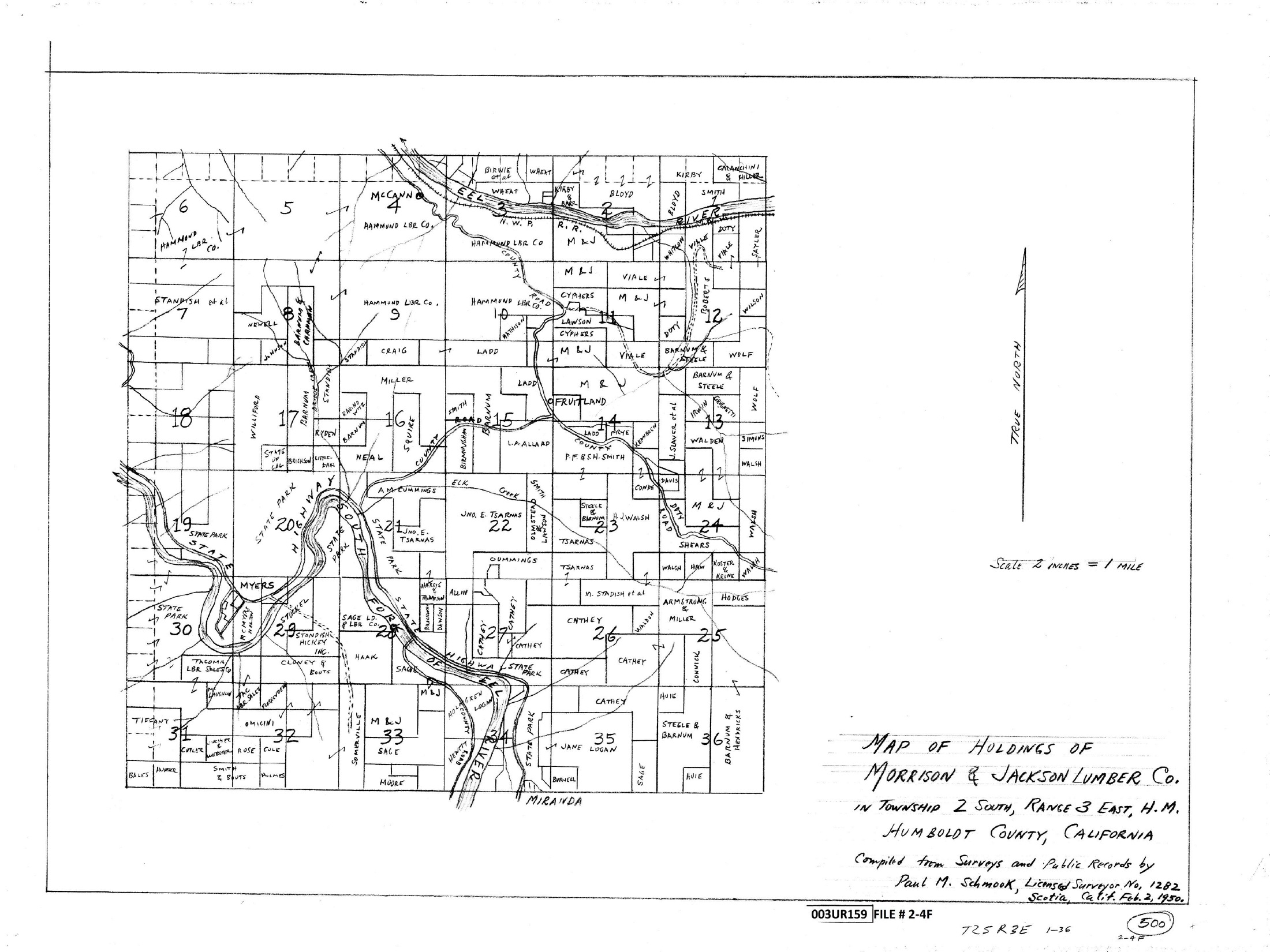
Map of holdings of Morrison & Jackson Lumber Co. in Township 2 South, Range 3 East, Humboldt Meridian. Compiled from surveys and public records by Paul M. Schmook, dated February 2, 1950. It depicts historical landholding names, rivers, roads and the railroad across the township.
Record details
Map scans
Select an image to enlarge it, or open the original PDF for full detail.
Reading this historical map
This scan records historical mapping. Its names, lines and annotations do not establish present ownership, boundaries or public access.
Citation
Paul M. Schmook. 1950 Morrison & Jackson Lumber holdings. 1950-02-02. Humboldt County reference 3 UR 159. Original scan in the Jay Smith Road historical collection; reviewed 21 October 2026.