Tools

Jay Smith Road in Humboldt County, California#
Jay Smith Road is a rural road in unincorporated southern Humboldt County, California, in the broader Humboldt Redwoods and Avenue of the Giants region. This public reference library brings together the area's historical survey framework, maps, road-related documents, utility instruments, water-history records, and environmental agency publications. It offers a starting point for understanding the documentary history and finding the sources behind it.
The nearby communities of Myers Flat and Miranda provide regional context. Their postal references—Myers Flat, CA 95554, and Miranda, CA 95553—help explain locality names encountered when researching southern Humboldt. They are not used here to assign the whole road to a particular postal boundary. Historical records also describe the area through Township 2 South, Range 3 East, Humboldt Meridian, a different geographic framework from a mailing address.
Start with the Jay Smith Road history overview for the documentary sequence, historical maps and survey sources for the map collection, or the catalog of public records for individual documents. The library describes historical evidence without determining present property ownership, road status, access, or boundaries.
Explore the region#
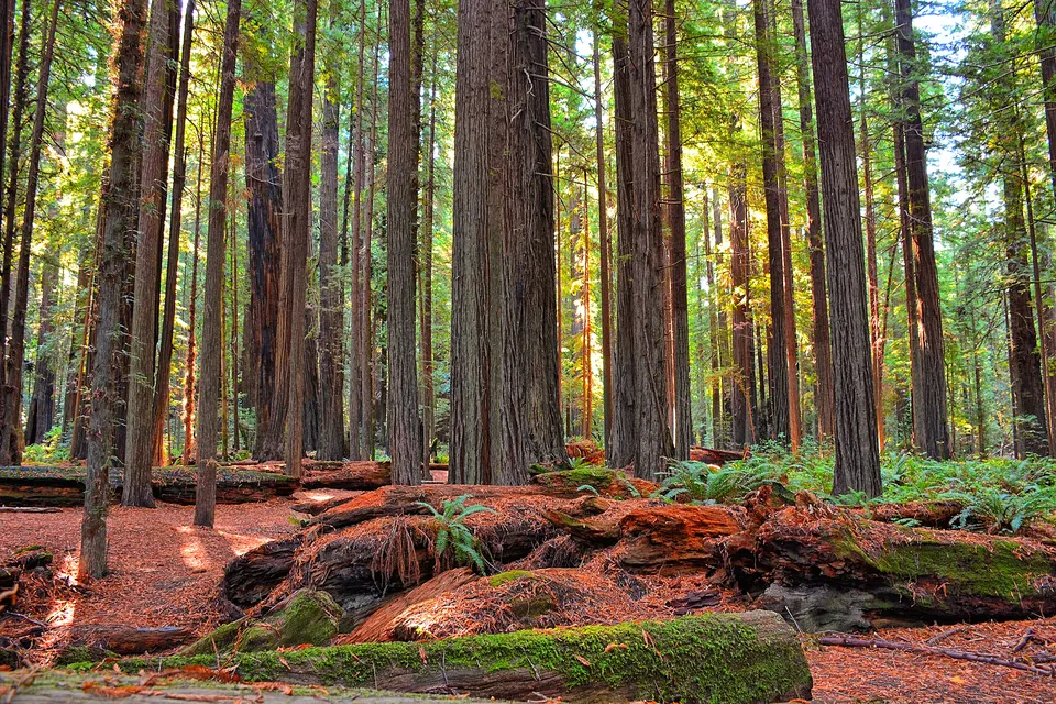
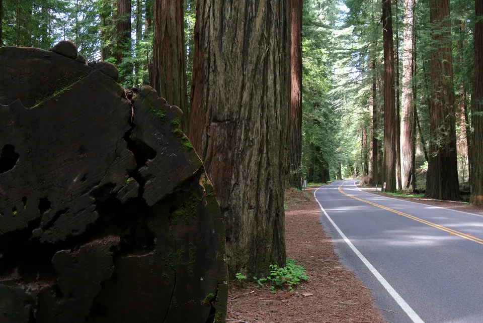
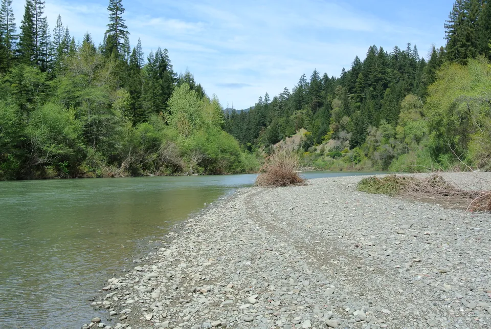
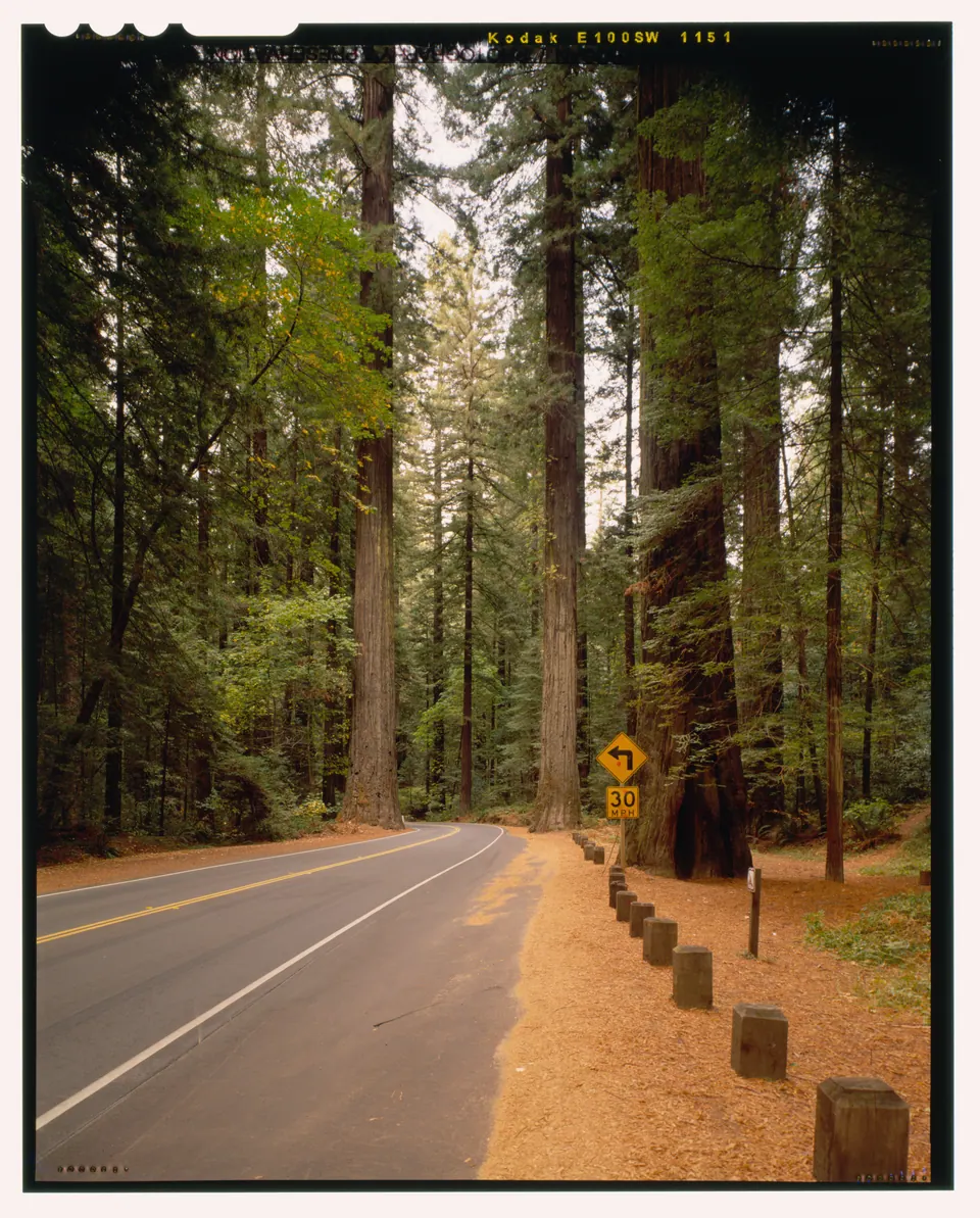
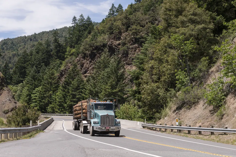
.jpg)
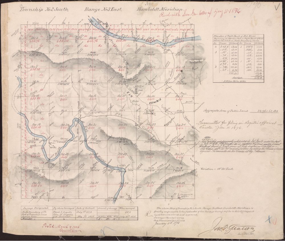
Photographs: Kirt Edblom, Adbar, Brian Grogan (HAER), and Carol M. Highsmith. Creator credits, dates, sources, and licenses. Township plat provenance.
Live regional conditions#
River observations, weather forecasts, road reports, and park notices from official regional sources.
Geographic setting in southern Humboldt County#
Geographic descriptions in the library serve different purposes. Humboldt County identifies the county; southern Humboldt describes the broader region; community and postal names help orient readers; and township, range, and section references identify the historical survey framework. A State Parks project description identifies an agency's project setting. These references can be useful together without being interchangeable.
Myers Flat and ZIP Code 95554#
Myers Flat, California, appears on the California State Parks brochure map for Humboldt Redwoods. The USPS Myers Flat post office listing associates the community name with ZIP Code 95554 and State Highway 254. These are useful regional and postal reference points when reading about the Jay Smith Road area, rather than evidence that every part of the road lies within Myers Flat.
Miranda and ZIP Code 95553#
Miranda, California, is also shown on the park map. The USPS Miranda post office listing uses ZIP Code 95553 and State Highway 254. The library's existing general-location overview places the Jay Smith Road area north of Miranda. A nearby community name provides orientation; it does not supply surveyed endpoints or establish municipal membership.
For address-specific postal questions, consult USPS using the particular address. For historical research, retain the locality wording used by each source and record its date. That approach preserves the distinction between a postal reference, a community label, an agency project area, and a surveyed land description.
Avenue of the Giants and Humboldt Redwoods State Park#
The Avenue of the Giants, California State Route 254, is an important regional reference for the Humboldt Redwoods landscape. The official Humboldt Redwoods State Park page introduces the park and links to its maps and brochures. The park brochure shows Myers Flat and Miranda in the surrounding corridor. These sources help readers place the historical library within the redwood region of California's North Coast.
State Parks records are relevant for more than general orientation. The 2006 Jay Smith Road Sudden Oak Death containment notice describes a project within Humboldt Redwoods State Park. The department's 2019 final-draft Road and Trail Management Plan, in its discussion of forest pathogens, also names Jay Smith Road in southern Humboldt County. This is dated environmental context, rather than a report of present conditions.
Use the park's own maps for its published geographic information, the maps and surveys guide for historical map interpretation, and the environmental-history article for the documented project and research sequence. Their different purposes matter: a visitor map, a proposed road map, and an environmental project record answer different questions.
Historical overview: a documentary sequence#
The library's earliest map is an 1876 township plat, preserved here as a county survey record copy identified by 100 UR 445. It provides the survey setting for later descriptions. The collection then moves to twentieth-century records: a proposed road map, electrical and telephone instruments, and recorded deeds with water and traveled-way references.
Documents associated with Jay J. Smith and Mildred E. Smith include the 1952 PG&E instrument and the 1959 Smith-to-Clarke deed. A 1958 telephone grant adds a separate utility record. The 1978 Phillips-to-Watts deed identifies the earlier overflow-water provision. These are selected historical records, rather than a complete history of every transaction or activity in the area.
The later environmental sources introduce another kind of evidence: an agency project explicitly titled with the road's name and a Forest Service publication discussing the Jay Smith treatment site. The source-linked historical timeline connects these periods without treating gaps between documents as evidence of an unrecorded event.
Humboldt Meridian and the historical survey framework#
Humboldt Meridian is the principal-meridian reference used in the historical township descriptions collected here. In the Public Land Survey System, township and range notation organizes land descriptions through a survey grid. “Township 2 South, Range 3 East” identifies a township's position relative to the governing baseline and meridian; it is not a community or street address.
A survey township is nominally six miles square and usually divided into 36 numbered sections. A section number narrows the description within that township, while quarter-section language identifies a smaller subdivision. Actual historical survey evidence must still be read on its own terms. The Bureau of Land Management's land-description guide explains the general township-and-range system; its regional examples use a different meridian.
The Humboldt Meridian survey-history article explains the library's 1872–1876 chronology. It preserves an unresolved distinction between dates associated with field work, corners, approval, and filing. The available accounts should not be compressed into a single asserted survey date.
For archival research, the National Archives Record Group 49 guide lists Humboldt Meridian township maps maintained by the Eureka land office. That collection-level reference is a research lead. A precise archival citation for the relevant original plat or field notes still requires confirmation.
Historical maps and recorded survey sources#
The map collection currently centers on two identified records. The 1876 Township 2 South, Range 3 East plat, 100 UR 445, supplies the historical township framework. The 1952 proposed road right-of-way map, 3 UR 137, documents a proposed alignment. Each has an HTML reference page, a preview, and a link to the public document.
When comparing them, begin with what each map was created to show. A township plat and a proposed road drawing are not equivalent maps at different dates. Check the title, date, scale, annotations, and record reference before comparing a feature. A line drawn on an old proposal does not establish that construction followed it.
The Jay Smith Road historical maps guide separates the available scans from additional government mapping and archival research sources. It also points to county survey resources. The library does not present an invented modern road map or convert the scanned documents into a new parcel-boundary overlay.
Road history and historical road records#
The 1952 map is a useful entry into road history because its purpose is explicit: it is a proposed road right-of-way map. Its catalog identifier, 3 UR 137, gives researchers a specific reference to follow. The map supports discussion of the historical proposal; evidence about construction or subsequent use would need to be identified separately.
The 1959 Smith-to-Clarke deed contains a traveled-way reservation as well as a separate overflow-water provision. Those subjects should remain distinct when summarizing the document. The electrical and telephone records, meanwhile, are utility instruments and should be read according to their own stated purposes.
The official 2006 environmental notice provides a later, independent use of the name Jay Smith Road. Together, these records show why a road-history inquiry can involve maps, recorded instruments, and agency publications. The road-history section links the evidence without declaring the current road public or private or offering access directions.
Utility records: electrical and telephone history#
The electrical record is a 1952 PG&E right-of-way instrument, reference 1202-03-0050, associated with Jay J. Smith, Mildred E. Smith, and Pacific Gas and Electric Company. The library supplies the public scan and identifies it as an electrical-utility record. Its reference number should be retained when citing or comparing it with other documents.
The telephone record is a Pacific Telephone and Telegraph right-of-way grant, dated 12 June 1958 and recorded 12 August 1958 in Humboldt County Official Records 499/422. Both the grant image and recording-page image are linked from its record page. The two dates distinguish the instrument from its recording.
Read these records together through the utility-history overview. They document different utilities at different dates. Neither the shared historical context nor the phrase “right-of-way” makes them interchangeable with a road instrument or establishes the condition of present utility infrastructure.
Water history: the tank and overflow-water record#
The water-history collection has a specific documentary basis. The deed dated 7 April 1959, recorded 22 April in Official Records 531/537, refers to use of overflow water from a tank north of the conveyed land. The deed dated 1 June 1978, recorded 26 June in Official Records 1498/555, identifies the earlier provision.
These references support a historical account of the tank-and-overflow wording and its appearance in later documentation. They do not identify the tank's original water source. The collection does not establish a spring, a watershed, a point of diversion, or a present water-system location.
The Jay Smith Road water-history article places the two documents side by side and explains the limits of the evidence. It keeps the physical tank reference, the historical document wording, and unresolved questions separate, making the material useful without adding a water-right conclusion.
Environmental history and Sudden Oak Death#
Environmental records provide independent public documentation using the road's name. On 18 January 2006, the California Department of Parks and Recreation filed a Notice of Exemption titled Jay Smith Road Sudden Oak Death Containment, SCH 2006018194. Its description places the project within Humboldt Redwoods State Park and states a containment or slowing objective for the infestation described at that time.
Sudden Oak Death is caused by Phytophthora ramorum, a fungus-like plant pathogen. The National Park Service overview supplies general disease background. The project notice supplies a different kind of information: a particular agency action, date, title, and identifying number. The local notice record page preserves those details and links to CEQAnet.
The later Forest Service research record#
The library also links to the 2017 Forest Service paper Conditions 10 Years After Sudden Oak Death Suppression Treatments in Humboldt County, California. The paper describes Jay Smith treatments involving host-tree removal with and without prescribed fire. Its observations concern the study conditions and observation period.
The environmental-history article explains how the notice and research complement one another while retaining their separate purposes. A containment objective is not proof of a long-term outcome; a historical study is not a current forest-condition assessment. The cited material also does not support describing the Jay Smith treatment simply as spraying.
A source-linked historical timeline#
- 1872–1876: survey chronology discussed in the federal survey history, with unresolved distinctions among dates.
- 1876: township plat, county survey record copy 100 UR 445.
- 1952: proposed road map, 3 UR 137, and a separate PG&E utility instrument, 1202-03-0050.
- 1958: telephone grant, dated 12 June and recorded 12 August, OR 499/422.
- 1959: Smith-to-Clarke deed, dated 7 April and recorded 22 April, OR 531/537.
- 1978: Phillips-to-Watts deed, dated 1 June and recorded 26 June, OR 1498/555.
- 2006: State Parks containment notice, 18 January, SCH 2006018194.
- 2017: Forest Service publication on conditions ten years after suppression treatments.
The complete library timeline is a finding aid to these documents. Its dates describe records and documented events, not a continuous account of every change in the area.
Public agencies and archives#
Different questions lead to different repositories. The Humboldt County Surveyor's resource page links to the county's map and corner-record index and identifies the County Recorder as the official repository for filed and recorded maps, deeds, and other documents. The library's reference numbers help readers identify the historical items they want to research.
California State Parks supplies park publications and environmental context; CEQAnet provides the state project entry; and the U.S. Forest Service publishes the research paper. The National Archives guide supplies a collection-level lead for federal land-office material. The public source register groups these entry points with the library's historical records.
Research methodology and source limits#
This library distinguishes original source material from its explanatory summaries. Begin with an individual record page, note the date and identifier, and then open the linked scan or agency publication. A summary helps a reader navigate a document; it does not replace the document's complete wording.
Historical terms and locality descriptions should be preserved in their original context. A proposed alignment, a utility instrument, a deed provision, and an environmental project each have a particular documentary purpose. Connecting them chronologically is useful, but does not turn them into a complete present title record or a definitive modern map.
Unresolved matters are identified rather than filled with assumptions. Examples include the survey-date questions, the origin of the tank's water, and the exact archival references still needed for original federal survey material. The About and methodology page explains the editorial approach and identifies the site's maintainer, The Urban Road Association.
Public source catalog and related records#
The historical record catalog gives each of the cataloged historical and agency documents a stable HTML page. Those pages include descriptive text, dates and identifiers where known, document links, citations, and connections to the relevant topic. The categorized source register adds research context and authoritative agency links.
- Surveys and maps: 1876 township plat and 1952 proposed road map.
- Utilities: PG&E electrical record and telephone grant and recording page.
- Water and recorded deeds: 1959 deed and 1978 deed.
- Environmental documentation: 2006 notice and 2017 Forest Service paper.
For reuse and citation work, the record metadata is available as JSON and CSV. The catalog is selective: it identifies the public sources assembled here rather than claiming to list every record concerning Jay Smith Road.
The wider historical landscape#
Jay Smith Road research also opens into the history of Humboldt Redwoods State Park, coast redwoods in Humboldt County, and the Avenue of the Giants corridor. These regional guides distinguish broader context from records specifically concerning the road.
The historical geography guide explains place names and rural postal references. The State Parks collection organizes agency material. Explore the photographic archive and licensed wallpapers for visual companions with documented provenance.
Frequently asked research questions#
Where is Jay Smith Road in California?#
The subject of this library is Jay Smith Road in southern Humboldt County, within the broader Humboldt Redwoods region. See the geographic overview for the distinction between regional, postal, and historical survey descriptions.
Is Jay Smith Road associated with Myers Flat or Miranda?#
Both are nearby community references in the broader park and Avenue of the Giants setting. Their respective postal ZIP codes are explained above. The library does not assign the entire road to either community or postal area.
Are there historical maps and surveys?#
Yes. The map guide introduces the 1876 township plat and the 1952 proposed road map. The survey article explains the Humboldt Meridian framework and remaining archival questions.
What does the library establish about road status?#
It identifies historical proposals, document provisions, and agency references. It does not determine whether the road is currently public or private or available for travel. The road-history overview explains the evidence used.
What is known about historical water use?#
The water-history page documents a tank-overflow provision in the 1959 deed and a reference in the 1978 deed. The source of the tank's water remains unresolved in those records.
Which government record explicitly names Jay Smith Road?#
The 2006 State Parks notice is titled Jay Smith Road Sudden Oak Death Containment and carries State Clearinghouse number 2006018194. Its relevance is explained in the environmental-history section.
Where should a new researcher start?#
Read the timeline to choose a period, then follow an individual record to its source. Use the source register to identify agency and archive entry points for further research.
Last materially updated and reviewed: 8 September 2026.
Recently added research#
- Moody Bridge in its river landscape
- River landscape from Greenlaw Vista Point
- Sunlight in the Avenue’s forest
- Jay Smith Road History
- Jay Smith Road water history: the tank record
- Coast Redwood History in Humboldt County
Browse all recent catalog additions
Featured record#
The 1876 Township 2 South, Range 3 East plat connects the library’s historical survey records with the Humboldt Meridian research guide.