Tools
A source-based reference library for the historical records connected with Jay Smith Road: the federal survey framework, twentieth-century road and utility records, recorded conveyances, water history, and environmental documentation.
- Earliest public record
- 1876 township plat
- Core period
- 1952–1978 recorded map, utility, and conveyance records
- Environmental record
- 2006 Sudden Oak Death project
- Editorial standard
- Records are described without determining present rights or boundaries.
Historical record sequence#
Use the sequence to enter the archive by period. Each event links to the relevant record or article.
Open the complete source-linked Jay Smith Road historical timeline
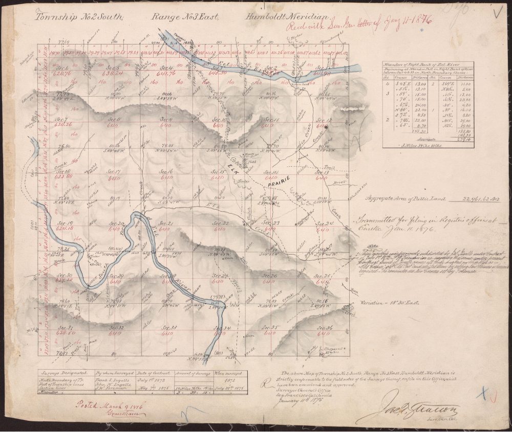
Federal survey framework #
Survey chronology, the 1876 plat, and the unresolved Foreman-date question. [1]
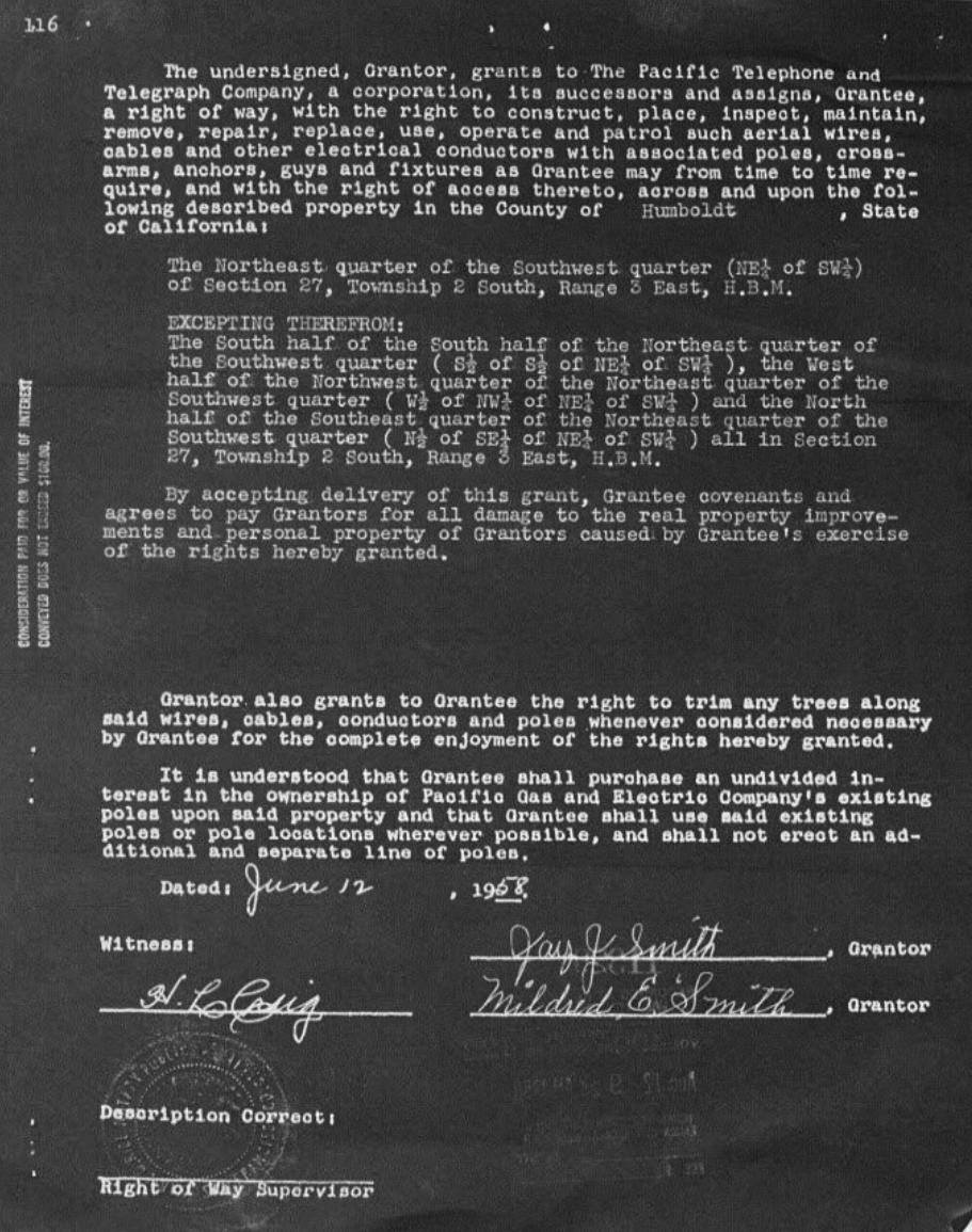
Smith-era utility records #
Separate electrical and telephone instruments record utility history. [3]
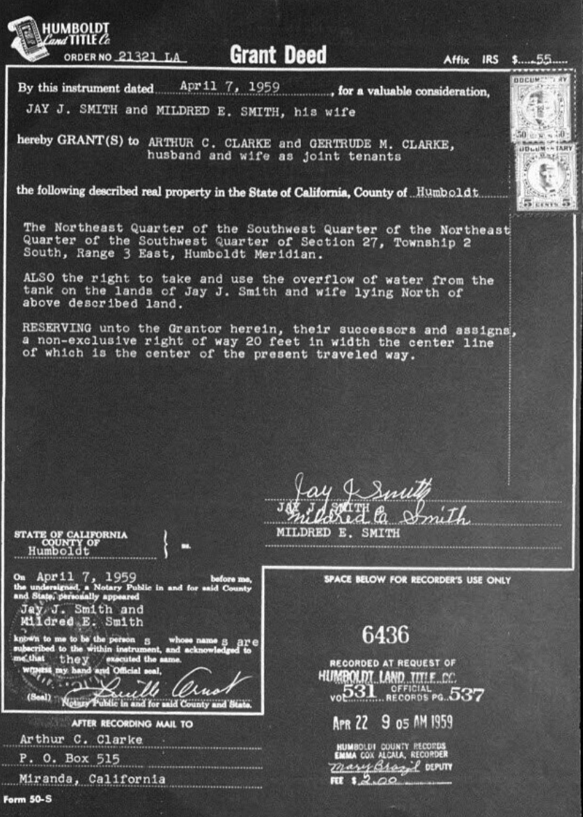
Recorded conveyances #
Historical deed provisions include the tank-overflow reference and a traveled-way reservation. [4]
Sudden Oak Death containment #
California State Parks environmental-management record. [5]
Federal surveys: the shared framework#
The historical records use Township 2 South, Range 3 East, Humboldt Meridian. The archive treats that language as a survey framework and directs readers to the survey article for the record chronology, source limits, and a plain-language explanation of the Public Land Survey System.
Road mapping#
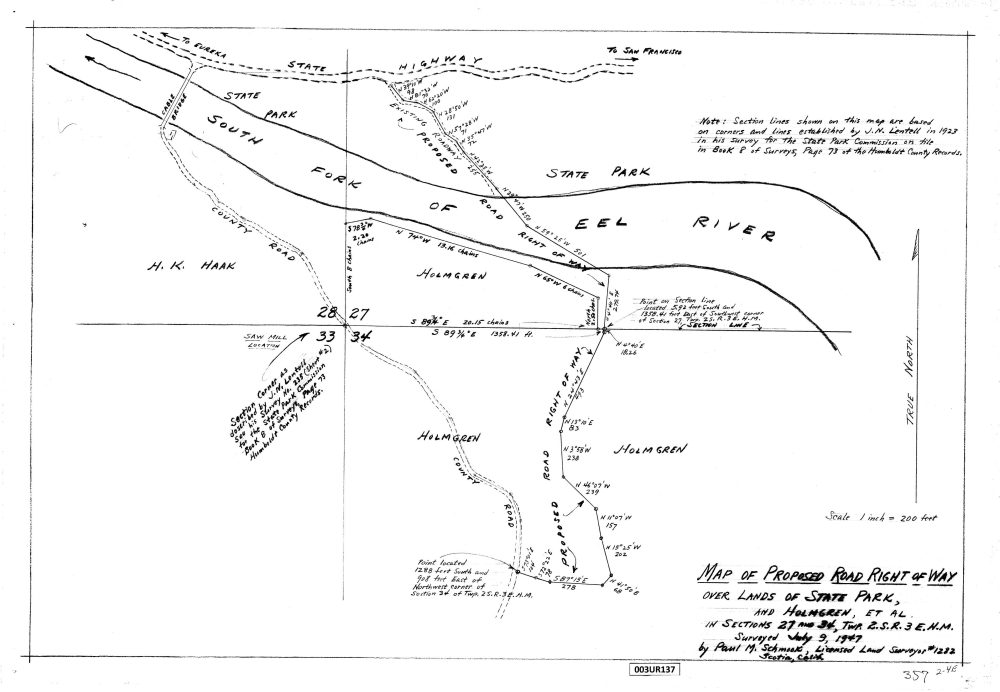
Proposed road right-of-way map#
What the record shows: a proposed alignment and its historical map context.
Comparing road-related sources#
The proposed road map should be compared with the 1959 deed's traveled-way reference as a separate kind of evidence. The map is a drawing of a proposal; the deed is a recorded instrument with its own wording and date. Neither should silently supply information missing from the other.
Later, the 2006 State Parks notice explicitly uses the road's name in its title. That gives a dated agency reference for road-name research. The library does not infer an opening date, construction history, current alignment, or legal status from that title.
Utility records#
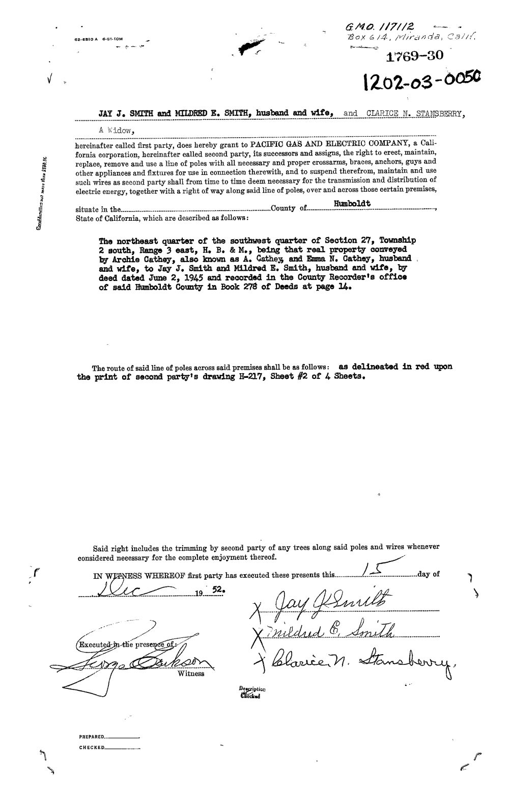
Smith-era PG&E right-of-way#
What the record shows: a historical electrical-utility instrument associated with the stated tract.
Telephone service in the historical record#
The Pacific Telephone and Telegraph grant is dated 12 June 1958 and recorded 12 August 1958 in Humboldt County Official Records 499/422. Its record page links both the grant and the recording-page scan. It complements the electrical record by documenting a different utility instrument six years later.
Use the dates and full references when comparing the records. “Right-of-way” appears in their titles, but the type of utility remains an essential part of the description. The library does not treat an electrical or telephone instrument as a road grant or describe present infrastructure from these historical scans.
Continue with the PG&E record, the telephone record, or the homepage utility-history summary.
Jay Smith-era documentary record#
The available documents record a 1952 electrical-utility instrument, a 1958 telephone right-of-way, and a 1959 conveyance by Jay J. Smith and Mildred E. Smith. A later 1978 grant deed refers to the earlier overflow-water provision. These records are presented as historical documents, not as a complete or current title record. [3] [4]
Environmental history#
The archive includes a 2006 California State Parks Sudden Oak Death containment record and a later Forest Service study. The article distinguishes the documented project from claims the available sources do not establish. [5]
Reading the Jay Smith Road documentary history#
The records assembled here describe selected periods in southern Humboldt County. The survey material supplies a framework for reading later descriptions; the road map records a proposal; utility instruments identify separate electrical and telephone documents; and the deeds preserve particular historical provisions. The environmental publications introduce agency and research perspectives from a later period.
A productive reading sequence is to begin with the Jay Smith Road geographic overview, then follow the historical timeline to a document. Keep its date and purpose in view. A later document may refer to an earlier instrument without supplying every intervening record. An agency publication may use a place name without attempting to define all of its geographic limits.
Dates and identifiers#
The telephone and deed records distinguish an instrument date from a recording date. Keep both when they are supplied. The county references OR 499/422, OR 531/537, and OR 1498/555 identify volumes and pages in Official Records; the catalog separately retains map references 100 UR 445 and 3 UR 137. These identifiers let readers return to the same evidence instead of relying on a shortened title alone.
Geographic descriptions across the collection#
Myers Flat and Miranda provide nearby community context in the Humboldt Redwoods region. Township 2 South, Range 3 East, Humboldt Meridian serves a different purpose: it identifies the historical survey framework. The maps and surveys guide explains how regional orientation differs from interpreting an individual historical map.
For a document-oriented route through the material, use the categorized source register. For the library's editorial approach and the distinction between a source and a summary, see research methodology.
Regional research collections#
- Humboldt Redwoods State Park History
- Coast Redwood History in Humboldt County
- Avenue of the Giants History & Records
- Southern Humboldt Historical Geography
- California State Parks Records
- Humboldt Highway History
Avenue of the Giants visitor information is kept separate from historical research.