Tools
A public reference record for a county survey record copy of an 1876 township plat used to explain the historical Humboldt Meridian framework.
Record details#
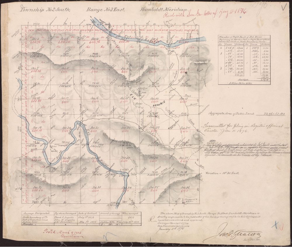
Neutral description#
The plat shows the historical township-and-section framework referred to in later historical descriptions. It is cataloged here as a source record, not as a current map of boundaries, ownership, access, or road status.
Historical context and use#
This is the library's earliest cataloged map. It provides the township-and-section framework used to explain later historical land descriptions associated with the Jay Smith Road research collection. Read the full plat alongside the Humboldt Meridian survey history, which separates the approval and filing chronology from unresolved dates in the earlier survey accounts.
The reference 100 UR 445 identifies the county survey record copy used here. It should remain part of a citation even when the title is shortened to “1876 township plat.” The public PDF and preview are reproductions for consultation; the library does not describe them as newly certified copies.
Citation#
Township 2 South, Range 3 East, Humboldt Meridian, 1876, county survey record copy, 100 UR 445; Jay Smith Road Historical Records, accessed 2 September 2026.
Last materially updated and reviewed: 8 September 2026.